
Flemish School, c. 1620
Estate map of Huyghe family between Bailleul and Saint-Jans-Cappel
Description:
inscribed throughout in brown ink
pen and brown ink and pink wash over traces of black chalk
285 x 415 mm
Provenance:
Librairie Raphaël Thomas, Rennes
Note:
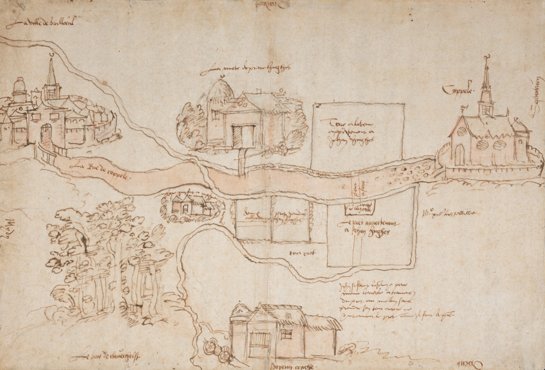
This manuscript map charts an area of approximately 5 kilometres detailing the roads, settlements, and farmland between the fortified town of Bailleul (‘La ville de Bailleul’) and the church of the village of Saint-Jans-Cappel (‘Cappele’), near Lille and the Franco-Belgian border. Today the land is part of France, yet in the early 17th century it was in French Flanders and part of the Spanish controlled Southern Netherlands.
The map is a record of the division of the Huyghe family lands and includes the plans for several landscape engineering works to be undertaken. The baptisms of the brothers Pierre and Jean Huyghe are recorded in the Bailleul civil register on 23 March 1588, and 7 May 1591, respectively. The date of death of their father, also named Pierre, is unknown, as is the precise date of their inheritance. A date around 1620 seems likely for the inheritance and creation of the map.